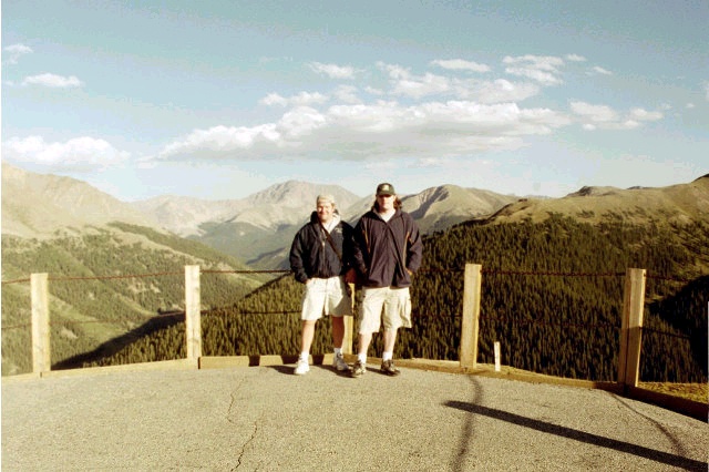
Jon and I visited nearby Independence Pass the afternoon before the hike.
Colorado
Mount Elbert
Elevation: 14,433 feet
Jon and I visited nearby Independence Pass the afternoon before the hike.
I hiked up Mt. Elbert with my friend Jon Leggett in August, 2002. We happened upon a perfect weather day for a mountain hike. No storms! Jon had driven me up Pike's Peak and Mt. Evans the summer before. We had fog and ominous thunder on Pike's and sleet on Evans. Somehow we got clear skies for our Elbert hike, and on a Saturday at that.
As it turns out, we needed the perfect weather. Neither Jon nor I were in ideal hiking shape. Plus, we got off to a bit of a late start around 8 AM. We had car camped in one of the sites near the North Halfmoon trailhead. Believe it or not, this is the only night I have ever spent in a tent! This shows you what an amateur suburban kid I really am at heart. I have a lot to learn if I'm ever going to tackle some of the tougher high points.
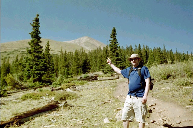
Apparently, it was blue t-shirt day for the twins...
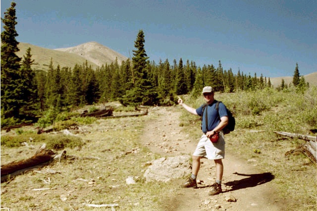
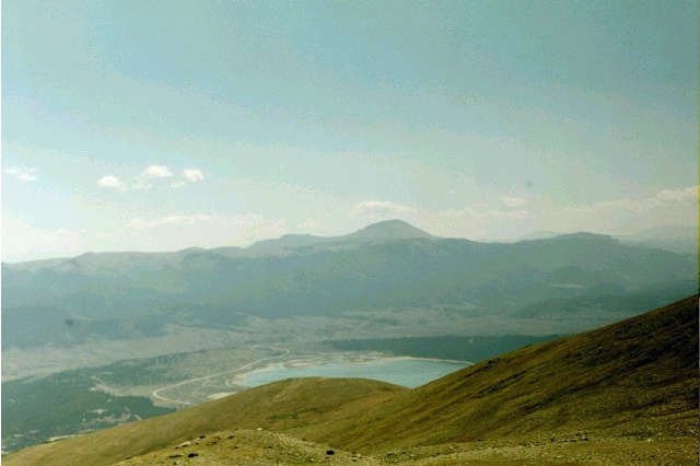
You can see what a false summit looks like here. This is a view from a clearing close to the tree line. This is the view of Elbert you have not only from the valley below, but all the way up the hike from the treeline. As we would soon learn, that is NOT the summit right there.
The hike started off as a pleasant walk in the woods. Then the trail started climbing. I had to keep updating my defnition of the word "steep" as we passed through the woods and then up out of the treeline. The northern route keeps getting more and more steep as it approaches the first (and worst) false summit. There's a ridge you can see as you come out of the treeline. It was a steep climb up that as we passed some resting boy scouts. Some of the kids looked like they had done enough climbing for the day, and we didn't see them again after we passed them on the way up. We stopped after cresting the ridge for a nice lunch looking down at the lakes before tackling the steep climb up around the false summit.
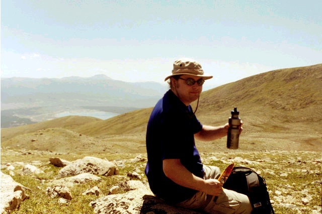
Here's the view from where we ate lunch (with and without me blocking the scenery). I called my brother on my cell phone from here.
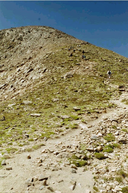
The trail gets even steeper after that first exposed ridge. This is what I remember as the steepest part of the climb.
You can sort of get a feel for both how many people were out climbing on such a nice day and for the steepness of the climb here. Those aren't really much in the way of switchbacks, either. You just have to climb. The last picture there shows the trail beginning to wind around the right side of what we were pointing at back down below the treeline. We really had an "almost there" feeling as we started climbing again after lunch. That just meant I had done a poor job visualizing how much hiking would remain after passing this point, though.
Up until hiking up around the first false summit, I had been bouncing up the mountain. Jon was hiking more slowly and steadily, and I would wait up for him to catch brief rest breaks. Now the trail kept going up, though not quite as steeply. Unfortunately for me, I hit a wall at this point. I had to stop every few steps. Now it was Jon's turn to wait for me. Eventually, though, we made the summit. I proceeded to take a nap for most of our half hour there, though the summit was full of chattering hikers. I was definitely in the worst hiking shape of the summit crowd. There was even a high school girl who apparently ran track because she had run up the southern route! (She had a group of friends who had carried up additional water for her.) Jon finally made me get up for the pictures and signing of the register, and we started back down as we were both feeling the altitude.

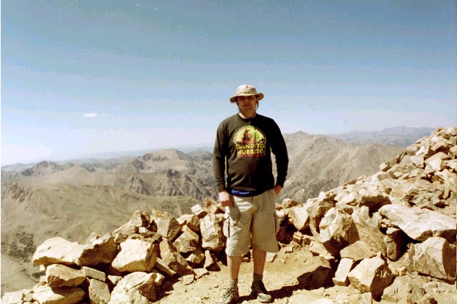
Putting a brave face on an ass kicking from 14,433 feet of elevation...
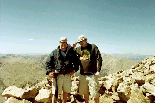
Putting a braver face on when someone else is taking the group shot. What a couple of tough guys!
Or maybe I look happier because I've got Jon to help me stand up. Jon is probably laughing at me. This wasn't his first "fourteener." You'll notice that I have put on my handy Bandito Burrito shirt to keep warm at the summit. The hike down was almost as painful as the last part of the climb, though I had to stop far less often. We got back after 5 PM, so our hike took us more than 9 hours. I felt pretty terrible until we had driven back to a gas station in Leadville and not altogether well until we stopped at the A&W in Frisco on the drive back to Denver.
I have to say I didn't feel very proud of my accomplishment due to the poor shape I was in by the time we reached the car. I plan to return to Elbert some day when I am in better shape. I think I'd like to tackle the southern route next time.
Thanks to Jon for the pictures as well as providing all the camping gear.